Mapping Maine
We Get What We Plan For: Thought-provoking Maps of Infrastructure in Maine
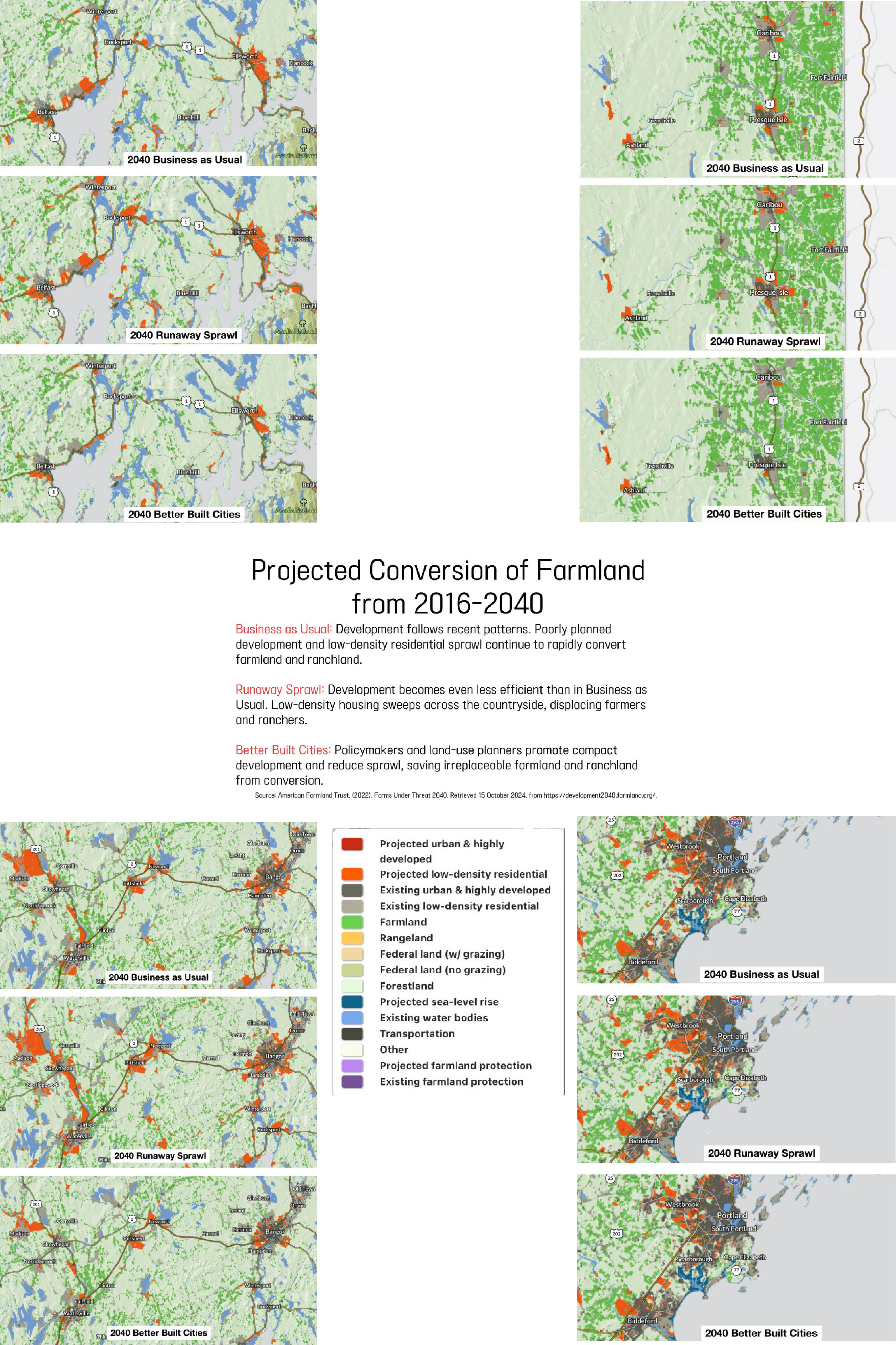
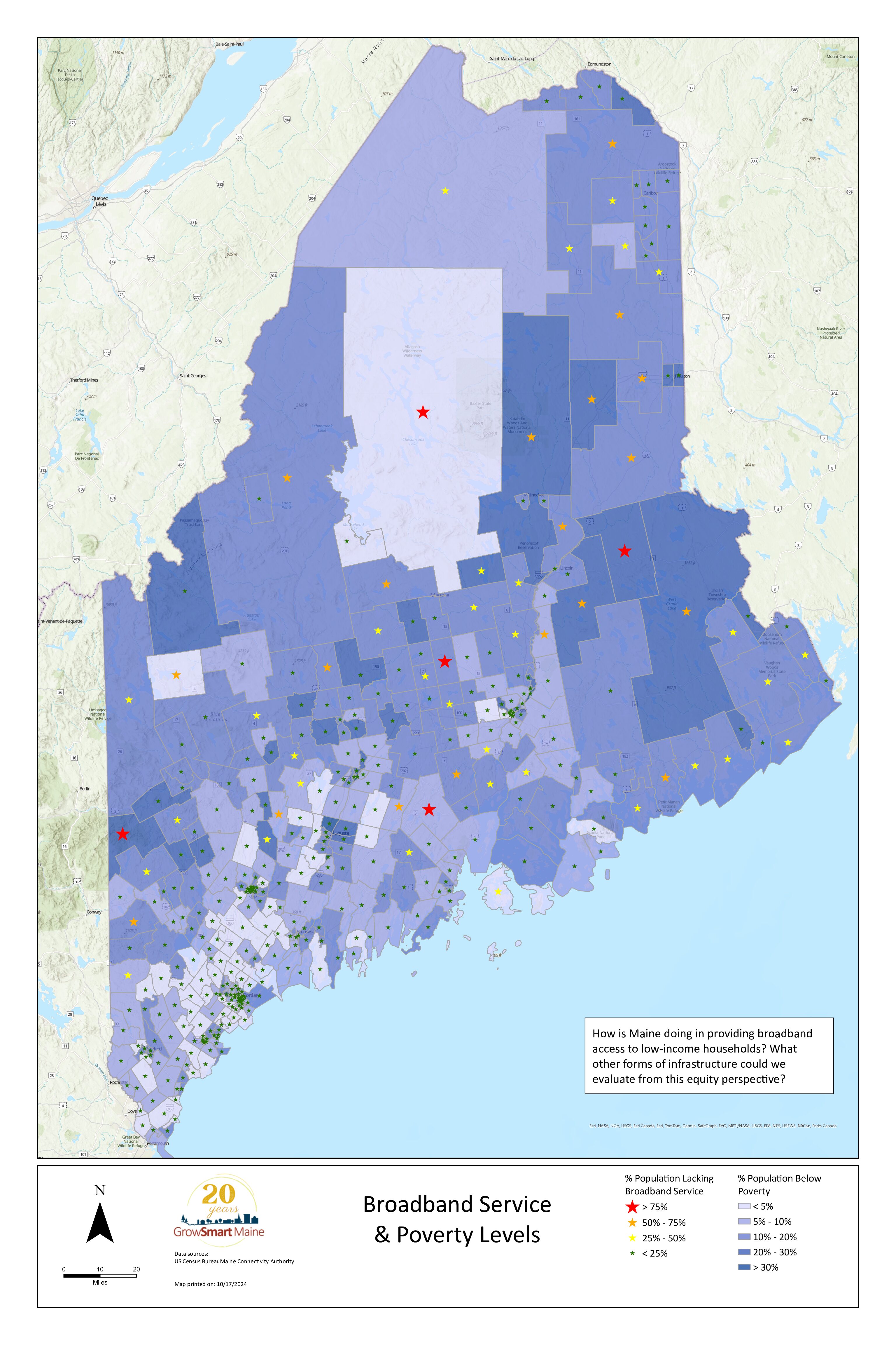
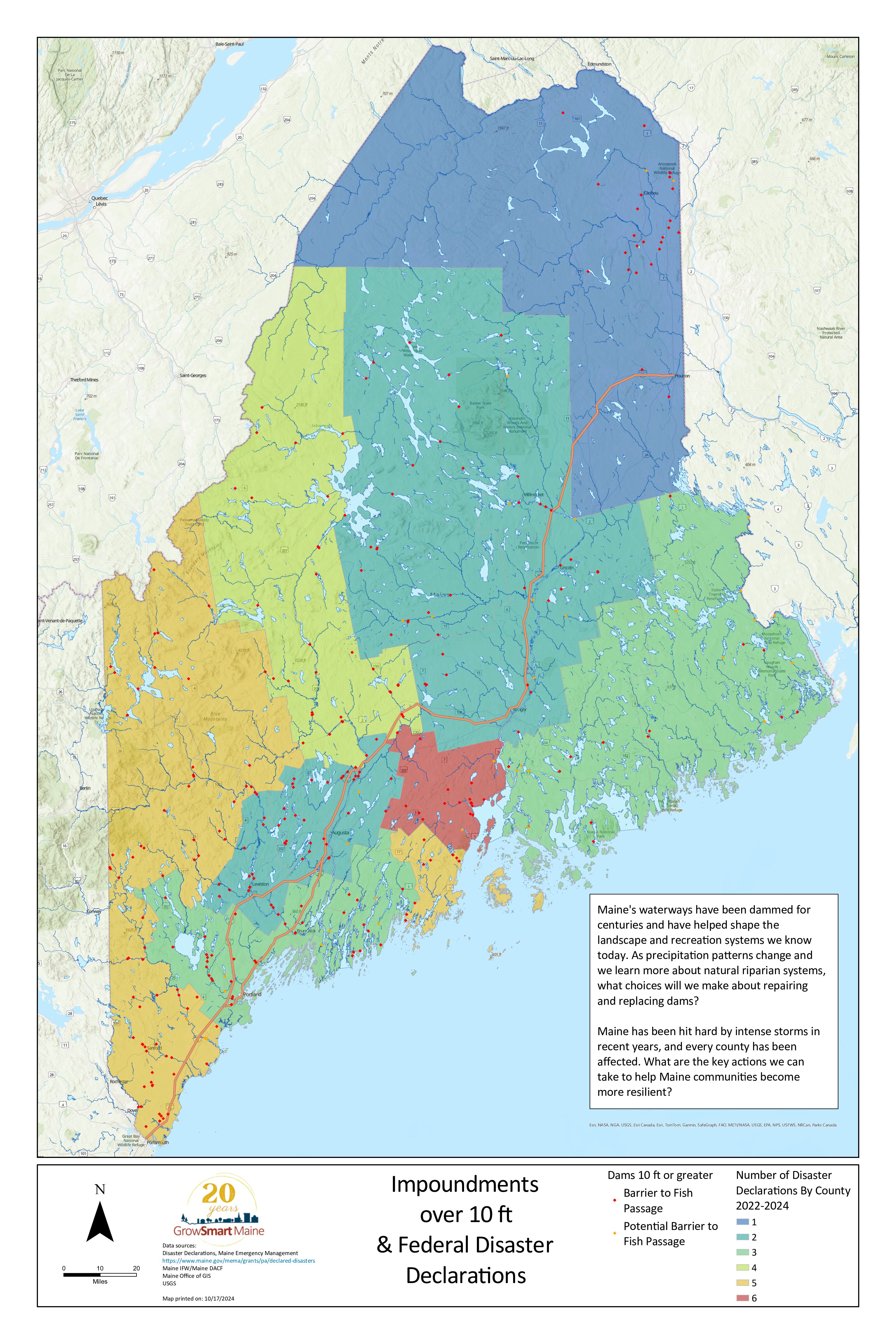
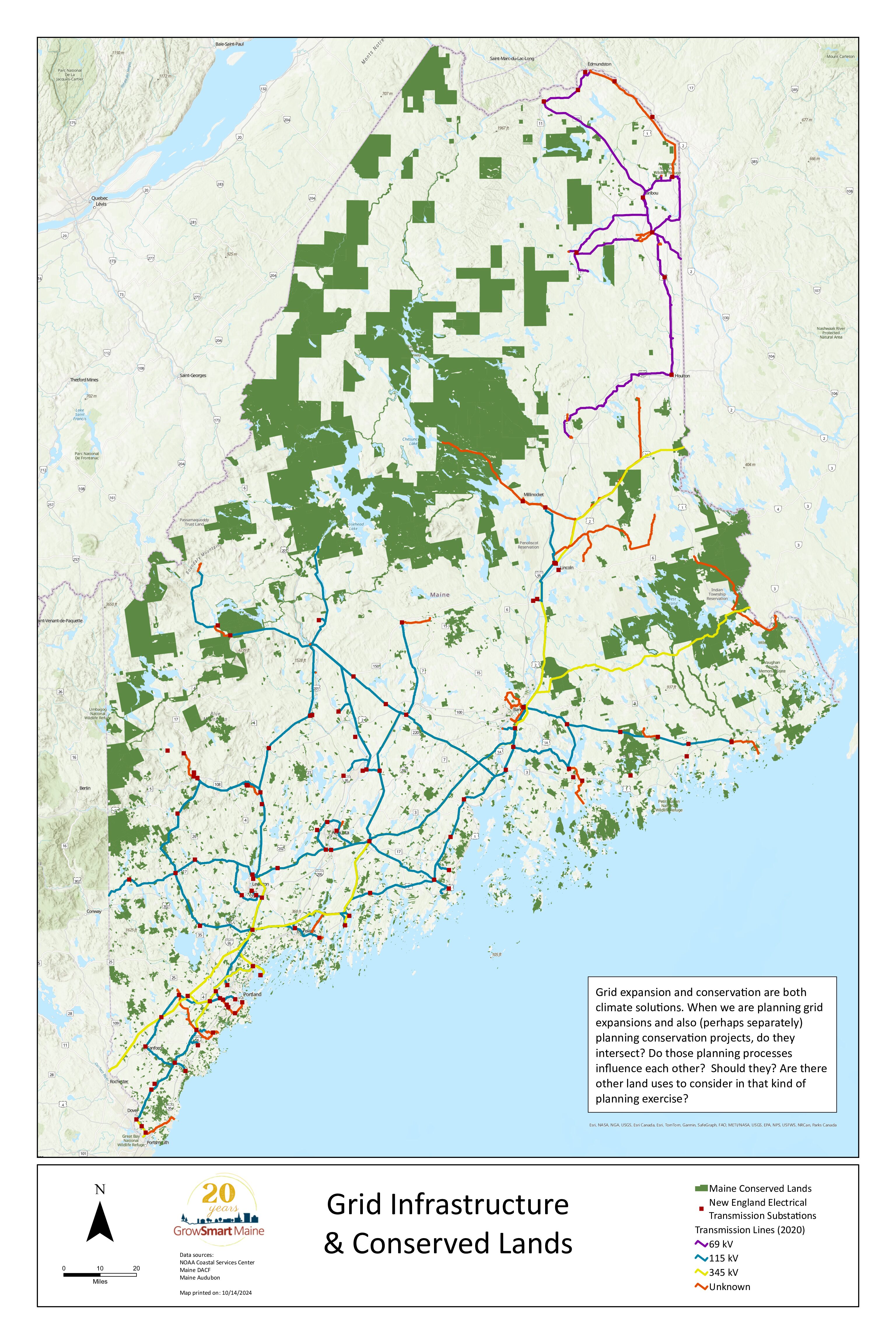
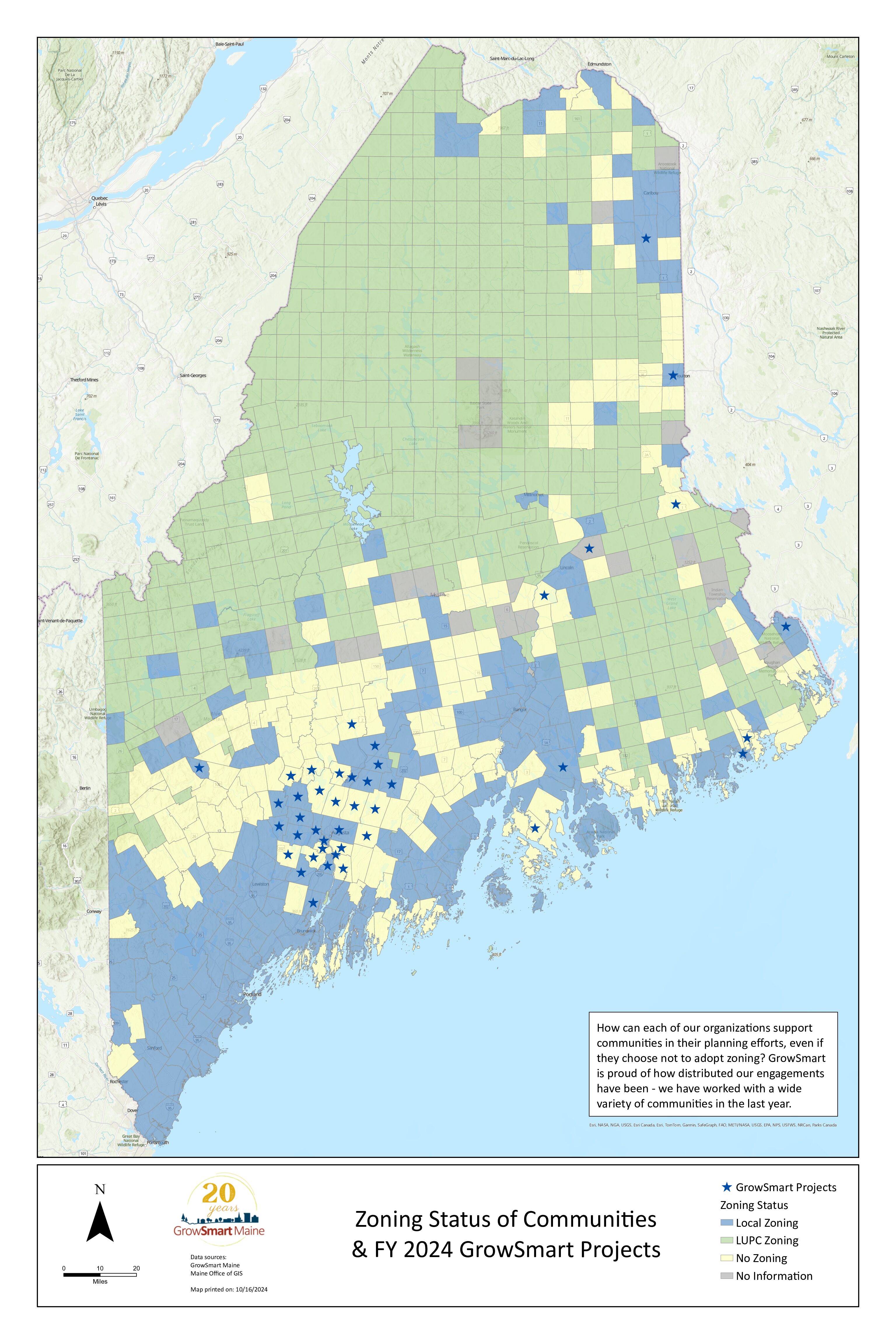
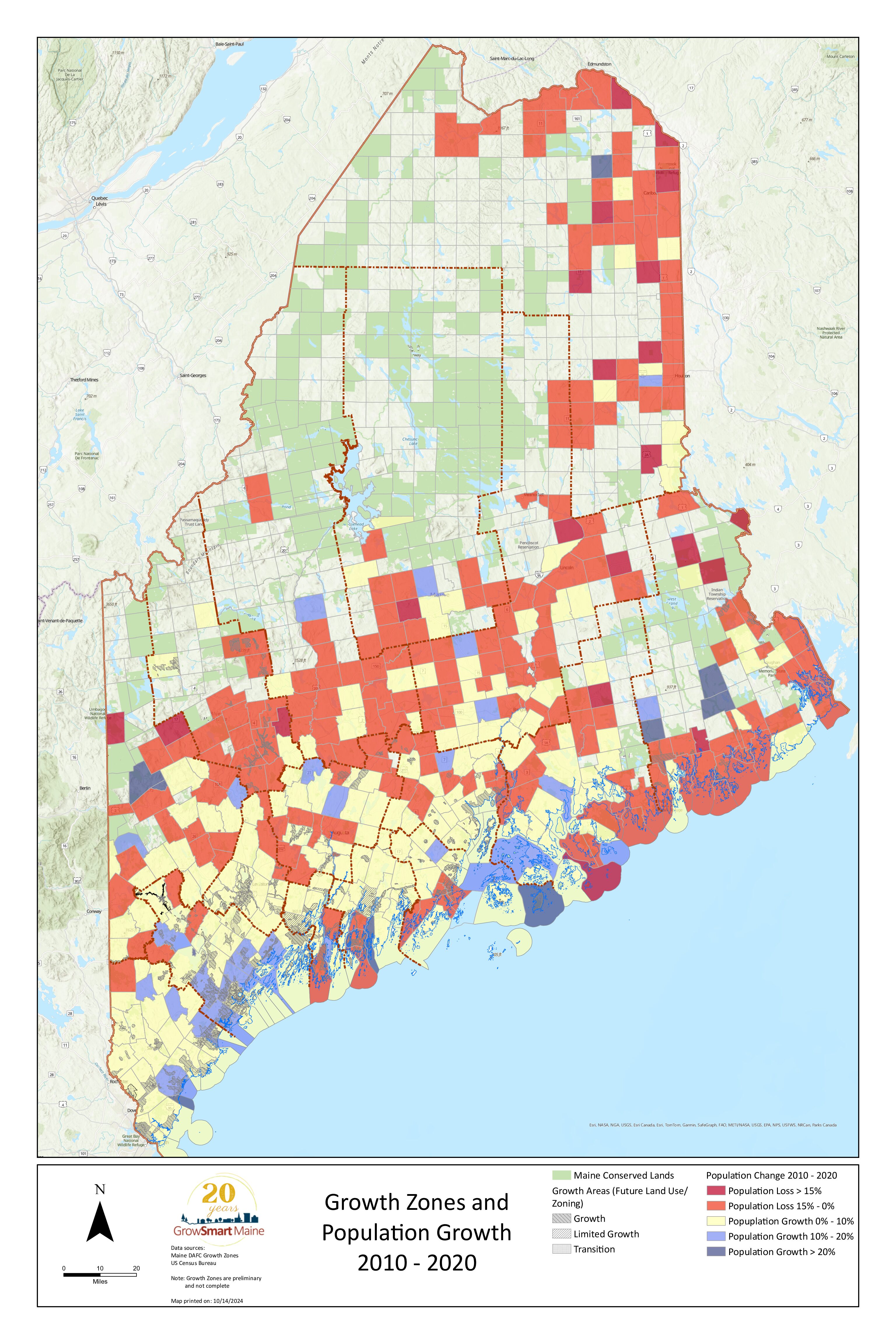
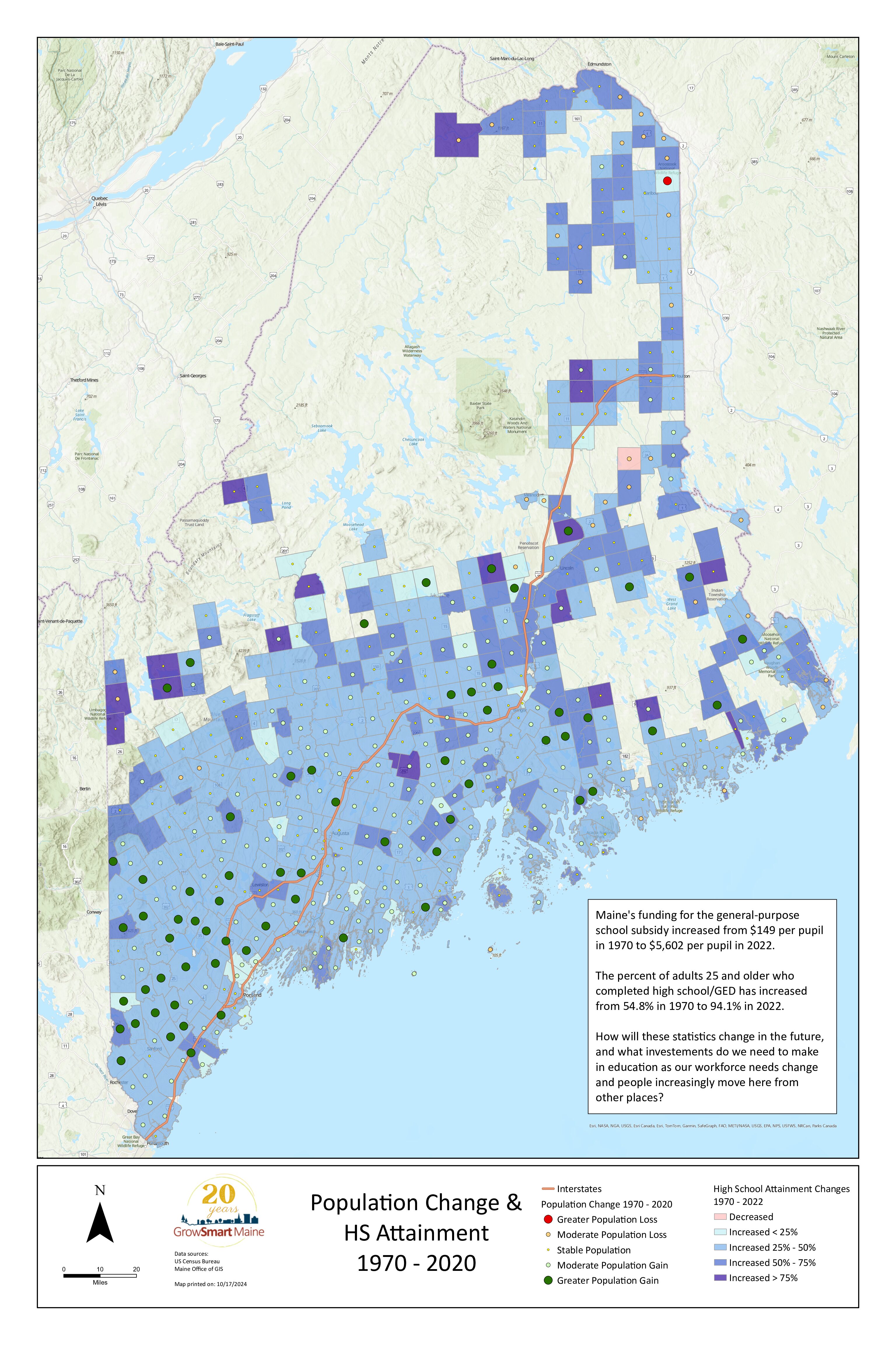
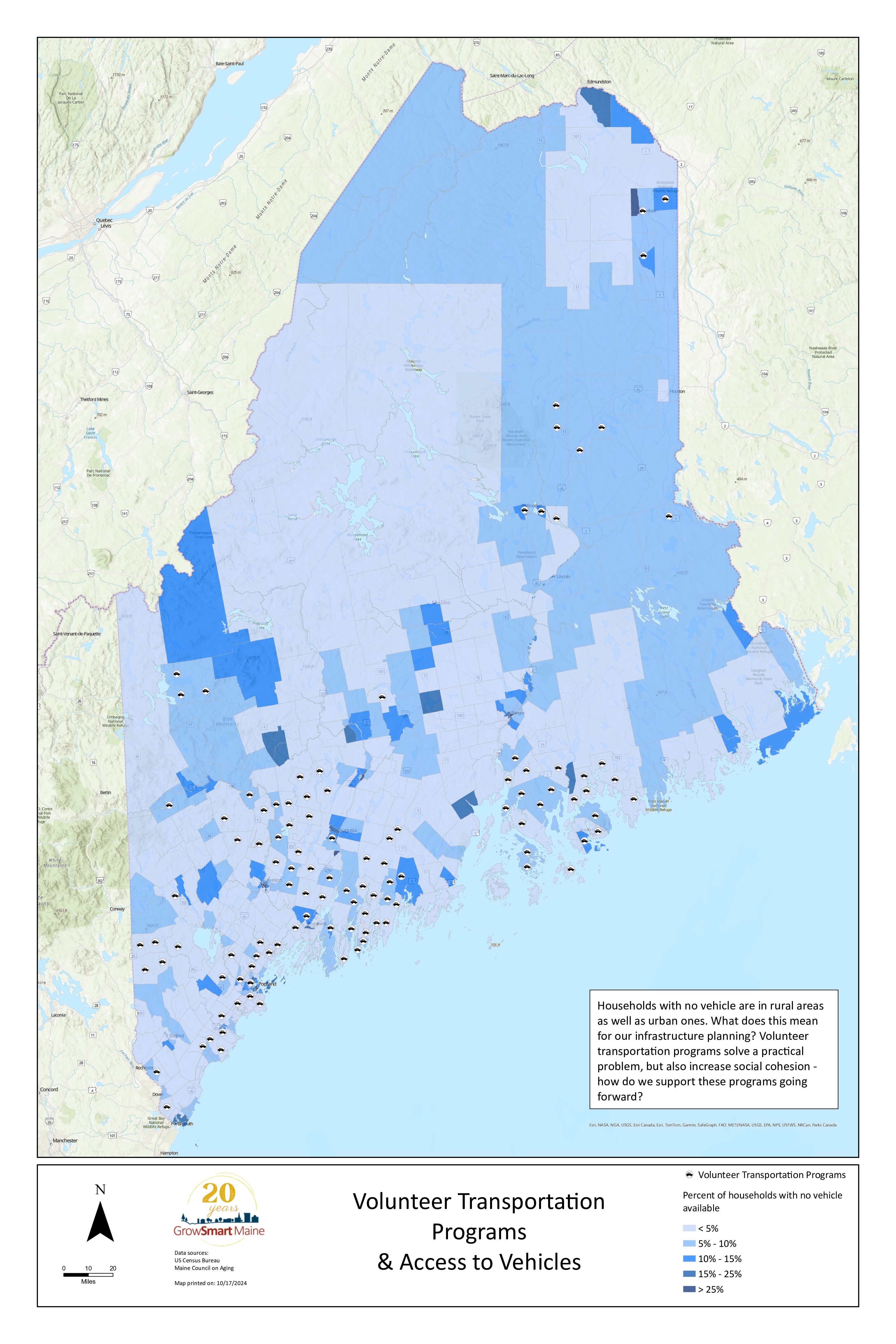
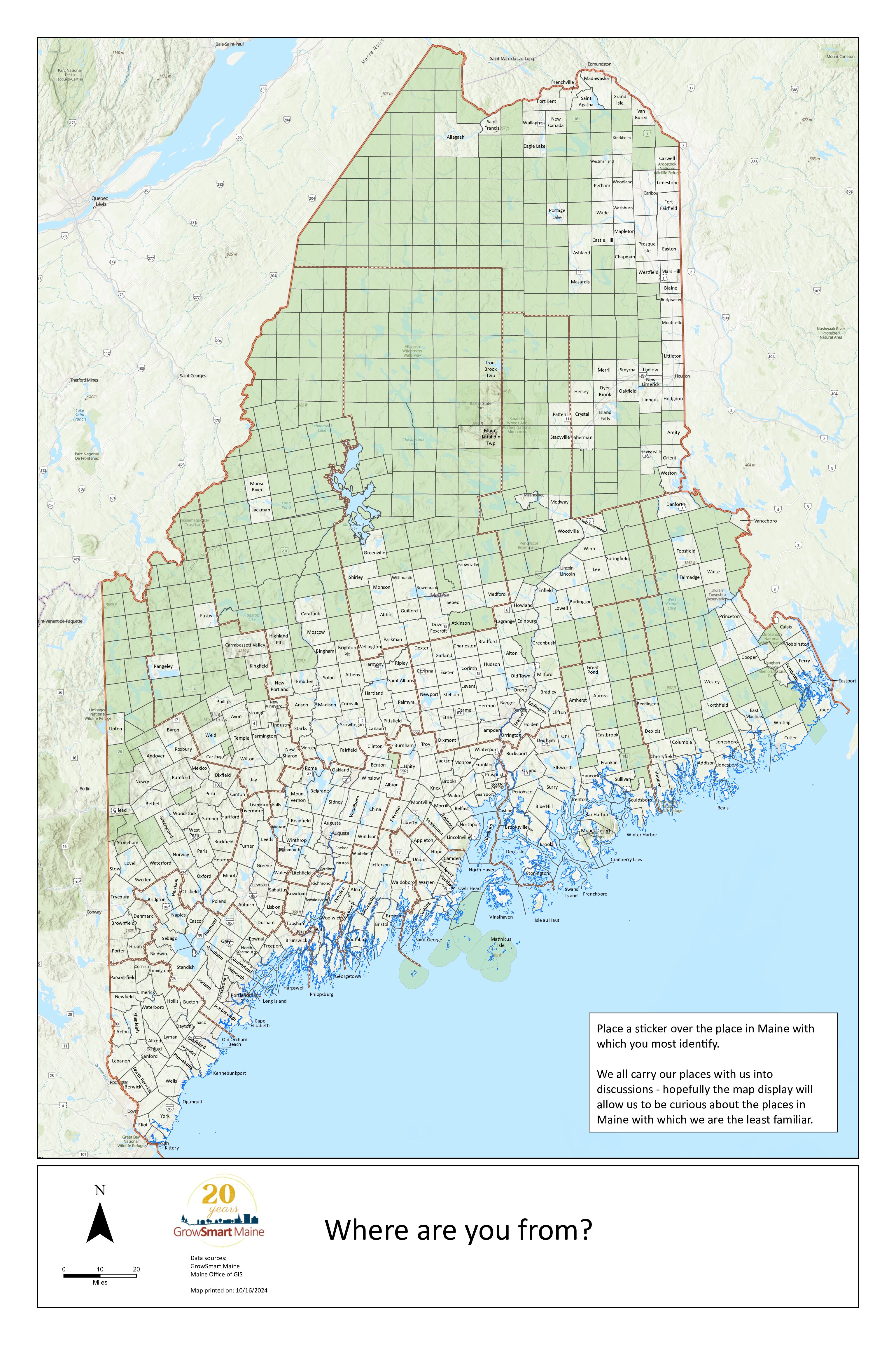
This series of infrastructure maps, plus a map for attendees of the GrowSmart Maine Summit 2024 to identify “their place”, is intended to spark conversations and stimulate curiosity about places and policy issues that may not be familiar to you, or that cross traditional subject area boundaries.
The idea for this map series was generated during a conversation among board members and staff at GrowSmart Maine’s annual retreat. In subsequent meetings, the planning group found data layers that were easily accessible, but were not familiar to most people, and that spoke to Maine’s future choices about infrastructure.
The maps do not cover all high priority issues! They are simply meant to be a spark for further conversations. What other maps should be created? What are you curious about? We hope that you have an “aha” moment as you talk with your colleagues about what you see here.
- Special Thanks to Judy Colby-George of VIEWSHED who took raw data and general ideas and turned them into these beautiful maps. Her contribution of time and resources was invaluable and generous.
Planning Committee Members:
Finn Bondeson
Harald Bredesen
Rebecca Casey
Judy Colby-George
Abe Dailey
Samantha Horn
Zoe Miller
Joe Oliva
Dayea Shim
Nancy Smith
We want to hear from you!
What do you notice about these maps – what is missing, what are you curious about, what do you wish you could see? Take a moment to reflect and let us know about what you’ll be taking away.

